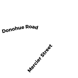
91 DONOHUE RD UN 17
Owner Information
MCCLORY NICOLE M. (JTRS)
91 DONOHUE RD UN 17
DRACUT, MA 01826


Property Details
91 DONOHUE RD UN 17 is classified as a Condominium (Condominium).
The primary structure on this property was built in 1986. There are 1,432ft2 of built area within this property. There is 918ft2 of residential/living space within this property. This property is listed as having 4 rooms.
91 DONOHUE RD UN 17 is valued at $200,200. The land is valued at $0 and the structures are valued at $200,200.
The most recent deed for 91 DONOHUE RD UN 17 is recorded at the local registrar in Book 31711, Page 0217. 91 DONOHUE RD UN 17 was last sold on Friday, December 8, 2017 for $185,000.
Assessment data from fiscal year 2022.
Flood Data
This property is partially within the AE Zone (within floodplain). Approximately 2.38 acres (60.43%) of the property is within this zone.
A portion of this property is denoted as being within a floodway.
This information is sourced from the FEMA National Flood Hazard Layer. See our full disclamer.
Broadband Internet Providers
| Provider | Type | Bandwidth (mbps) | |
|---|---|---|---|
| HughesNet | Satellite | 25 | 3 |
| Crown Castle Fiber | Fiber | 0 | 0 |
| GCI Communication Corp. | Satellite | 0 | 0 |
| T-Mobile | Fixed Wireless | 25 | 3 |
| VSAT Systems, LLC. | Satellite | 2 | 1 |
| Comcast | Cable | 1000 | 35 |
| Verizon New England Inc. | DSL | 15 | 1 |
| Viasat Inc | Satellite | 100 | 3 |
Broadband service provider data from December 2020.
Adjacent Properties
- 185 PHINEAS ST
Developable Residential Land owned by NEW ENGLAND POWER CO - 101 DONOHUE RD UN 01
Condominium owned by SWINIARSKI JOHN S. JR. & COLLEEN L., TR - 101 DONOHUE RD UN 10
Condominium owned by COOPER MARGARET M. (JTRS) - 101 DONOHUE RD UN 11
Condominium owned by TRAN LINH (TE) - 101 DONOHUE RD UN 12
Condominium owned by BRADLEY ALYSSA N. - 101 DONOHUE RD UN 13
Condominium owned by LYONS MICHAEL - 101 DONOHUE RD UN 15
Condominium owned by MARINILLI ALBERT - 101 DONOHUE RD UN 16
Condominium owned by RICHARD ELISHA - 101 DONOHUE RD UN 17
Condominium owned by GRAVELLI CHRISTINE - 101 DONOHUE RD UN 18
Condominium owned by ACKROYD ROBERT (TE) - 101 DONOHUE RD UN 19
Condominium owned by RAINS EARL - 101 DONOHUE RD UN 02
Condominium owned by ALLARD RON M. - 101 DONOHUE RD UN 03
Condominium owned by RODDY KATHLEEN A - 101 DONOHUE RD UN 04
Condominium owned by SOLIVAN HERIBERTO - 101 DONOHUE RD UN 05
Condominium owned by THEMELIS KIMBERLEY IND. - 101 DONOHUE RD UN 06
Condominium owned by LYNCH SHANNA L. (JT) - 101 DONOHUE RD UN 07
Condominium owned by MORRIS RODNEY E. (JT) - 101 DONOHUE RD UN 08
Condominium owned by PATTERSON KAREN A. - 101 DONOHUE RD UN 09
Condominium owned by RIOS HANNAH (JTRS) - 101 DONOHUE RD UN 14
Condominium owned by BROADBENT JAMES E. (TE) - 227 PHINEAS ST
Developable Residential Land owned by NEW ENGLAND POWER CO - 83 DONOHUE RD
Undevelopable Residential Land owned by LEMAY LUCIEN A